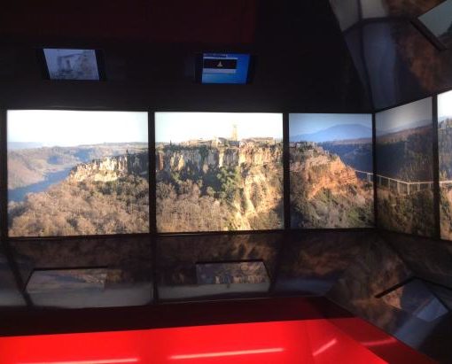
The Valle dei Calanchi is a territory bordered on one side by a valley where the Rio Torbido flows and on the other by the Fosso di Bagnoregio. It is a landscape of rare beauty and an open-air laboratory where combining methods for the prevention of natural risks with tests for monitoring systems and consolidation techniques. These operations are essential to make the valley accessible and observable over time. The marine clays that characterize the valley are attributable to the Gelasian-Santernian. In a first moment, they were covered by volcanic deposits from the Vulsino Volcanic District and then dug in the opposite direction, producing more or less deep valleys and characteristic ridges patterned by a constant work of erosion. The continuous and progressive attrition and corrosion have led to a rapid and spectacular evolution of the scenery and created a unique landscape. A case in point is the area of the Ponticelli, a thin clayey ridge featuring high vertical walls used by local residents to reach their fields. In some 50 years, erosion reduced the walkway from 2 meters to 2 centimeters, and it completely eliminated the passage. The so-called Montione represents another example of this kind of demolition. It is an isolated obelisk placed on the top of an erosion furrow east of Civita, a surprising surplus of volcanic soil characterized by striations of pumice, ash, and lapilli. An even more astonishing complex is placed on the eastern side of Civita. The Cattedrale is a high rock formation with clay peaks that resemble the spires of a cathedral. These pinnacles decrease in number year after year due to the corrosive action of atmospheric agents. Nowadays, the Valle dei Calanchi still appears like an expanse of sea waves, just as it once was.


